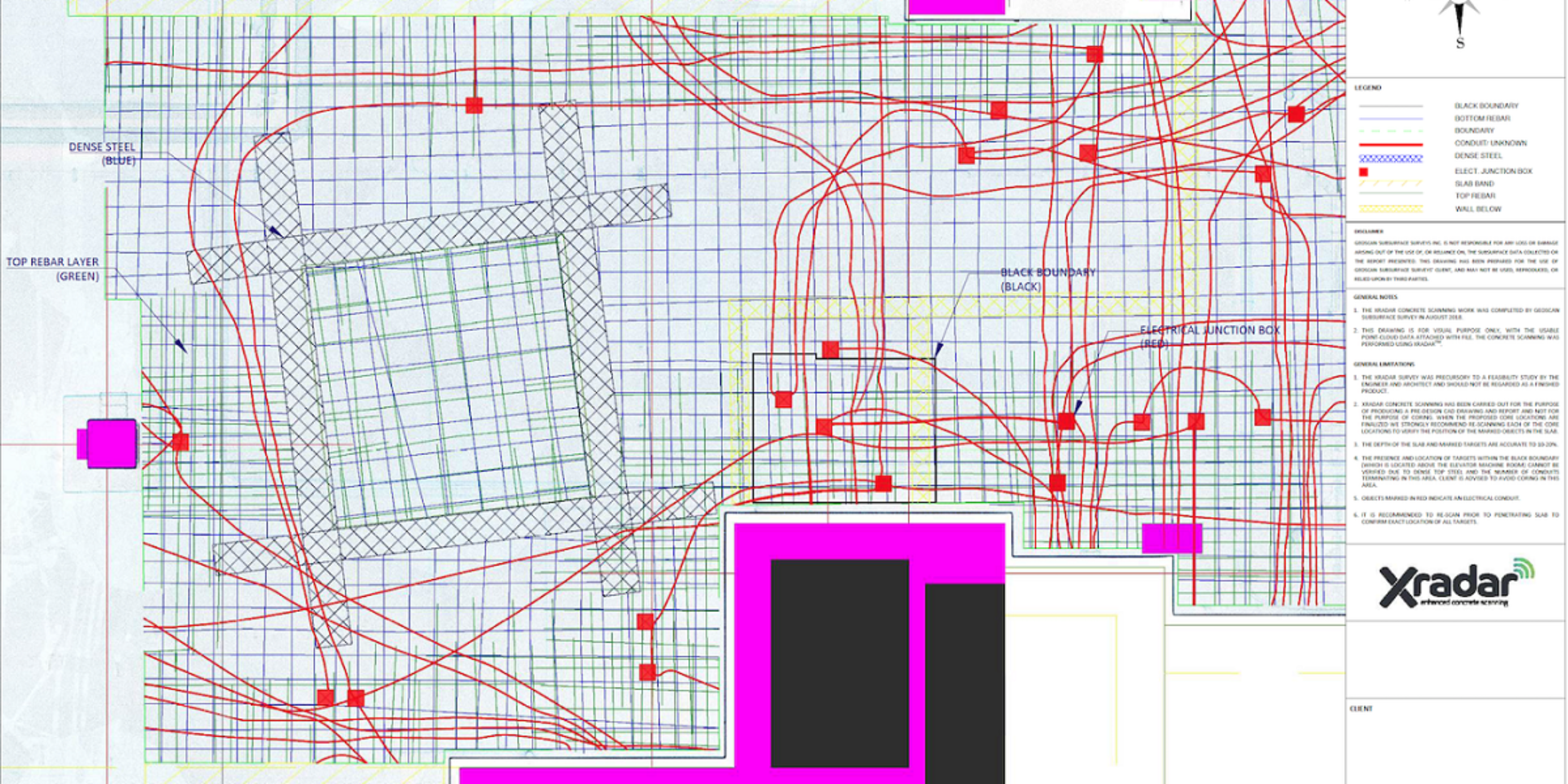
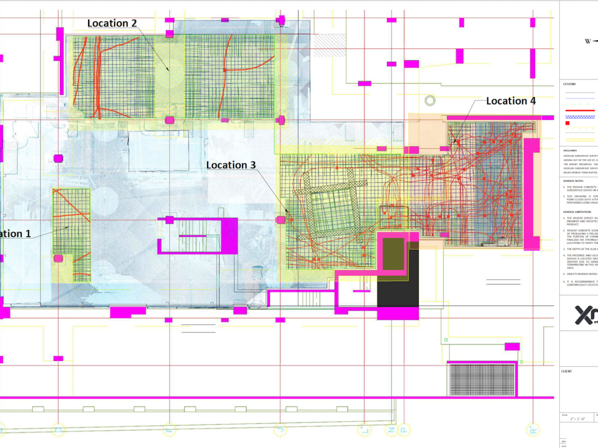
GeoScan utilised Xradar™ to carry out a pre-design survey for the construction of a Vancouver restaurant.
The purpose of the Xradar Pre-Design survey was to map all of the subsurface infrastructure and allow the architects and designers to effectively plan the layout of the property utilizing our as-built drawings.
Services
- Forensic/Crime Scene Geophysics
- Construction Layout Surveys
- LiDAR Services & Mobile Mapping
- GIS Utility Mapping
- Topographic Surveys
- Surveying
- Underground Oil Tank (UST) Locating
- Subsurface Utility Engineering
- Utility Line Locating
- Tree Root Mapping
- Asphalt & Pavement Thickness Mapping
- Archaeological Geophysics
- Ice Thickness Profiling – Lake, River and Road
- Contaminant Plume Mapping & Landfill Delineation
- Bedrock Mapping & Profiling
- Subsurface Void Locating
Industry
Concrete Scanning
A Vancouver restaurant was starting the construction process and wanted to create a sustained link between the design and construction phases of their project in order to mitigate risk and improve the speed and safety of the process.
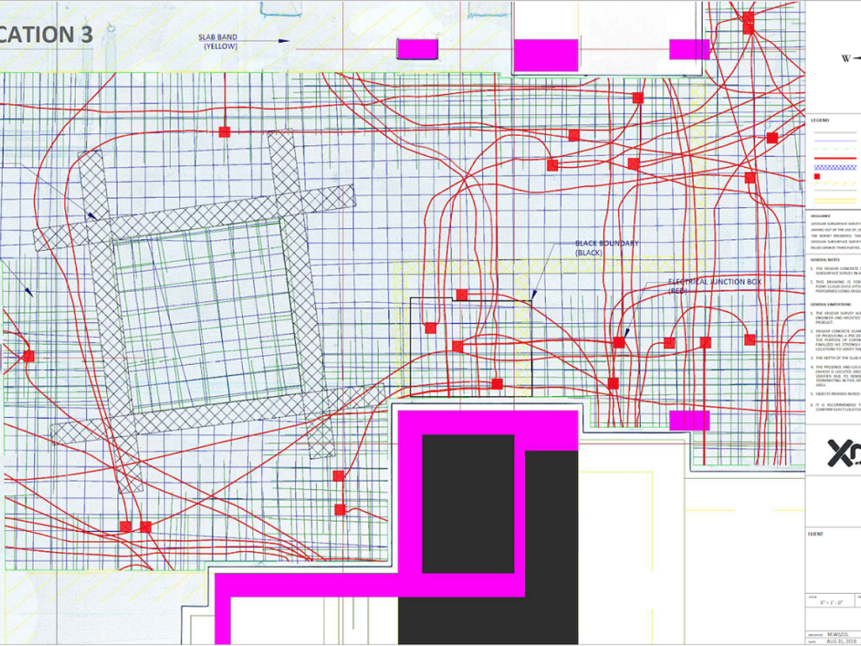
Our trained Xradar™ technician carried out a concrete scan of the site using our Xradar™ Enhanced Concrete Scanning System. A Pre-Design Scan of the site using 3D laser scanner was then used to capture the area.