In the rapidly evolving world of environmental engineering, geophysics plays an important role in enabling more sustainable and informed decisions. Near-surface geophysics, in particular, has become increasingly crucial for site characterization, utility locating, and mapping out known and unknown subsurface structures.
Geophysics involves the study of the earth’s physical properties and processes, ranging from oil and gas exploration to mineral exploration and seismology. However, near-surface geophysics, which typically focuses on depths up to 50 meters, is where environmental engineering and site investigations converge. This discipline uses non-destructive testing (NDT) methods to assess the subsurface without disrupting the environment.
Key Techniques in Near-Surface Geophysics:
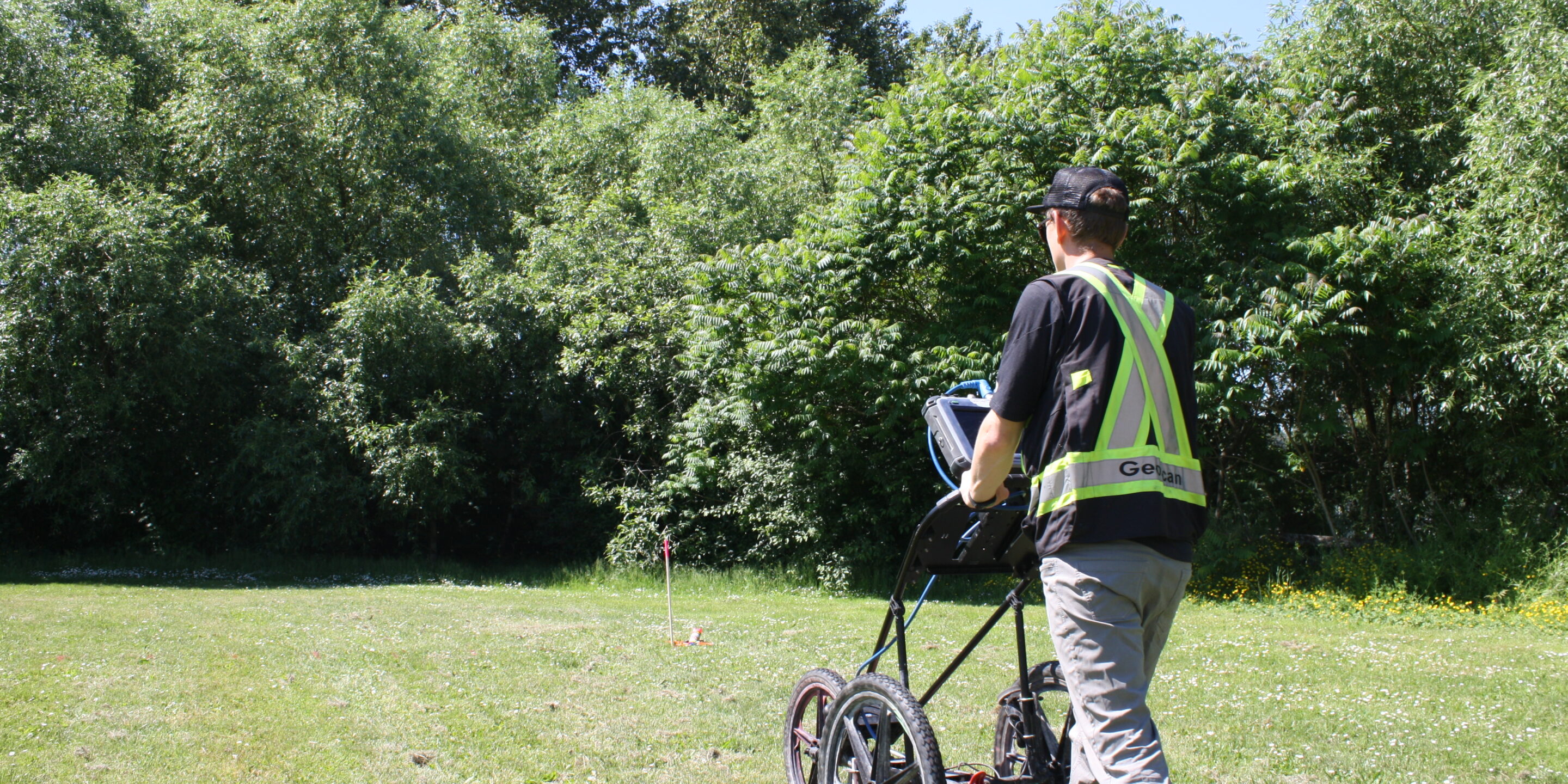
- Ground Penetrating Radar (GPR) transmits radar waves into the ground and detects changes in subsurface properties based on the reflection of these waves. It can provide a high-resolution image of electrical property variations within the subsurface but is limited when dealing with certain geological conditions like clay-rich soils.
- Electromagnetic Induction (EM) is a technique that uses time (or frequency) varying electromagnetic fields to induce eddy currents in the subsurface, which generate a secondary electromagnetic field that is used to measure the electrical conductivity and magnetic susceptibility of the subsurface. EM is well-suited for mapping contamination and identifying metallic objects, though its resolution is relatively low for deeper investigations.
- Electrical Resistivity Tomography (ERT) involves injecting electrical currents into the ground and measuring the resulting voltage variations along a survey line. This method creates a 2D cross-section of the calculated resistivity distribution of the subsurface, making it useful for tasks like bedrock mapping and groundwater analysis.
- By measuring anomalies in the Earth’s magnetic field, magnetometry helps detect buried materials with magnetic properties, such as certain minerals and metals. It’s often used in archaeological site investigations and for identifying buried infrastructure.
- Seismic surveys utilize mechanical waves to assess the subsurface’s mechanical properties, providing data on density and elasticity. Seismic method is especially valuable for detecting voids or mapping out stratigraphy.
GeoScan’s Approach: Multi-Method Integration
GeoScan’s geophysical team comprises experienced professionals with a deep understanding of both the science and its practical applications. The team leverages a multi-method approach, combining data from GPR, EM, ERT, and magnetometry to build a more reliable and comprehensive model of the subsurface. Aerial imagery and digital elevation models are often used for completing site characterization.
By integrating multiple datasets, GeoScan avoids the common pitfall of relying on a single method, which may only provide partial information. For instance, a GPR survey might identify a subsurface structure, while EM or magnetometry data can help in understanding material composition. Together, these datasets provide a clearer picture of subsurface conditions, allowing engineers to make more informed decisions.
Applications in Environmental Engineering
Geophysical techniques are now indispensable in various environmental engineering applications. These include but are not limited to:
- Highway and Railway Inspections: GPR is used to assess asphalt thickness and road base conditions, ensuring that transportation infrastructure remains safe and functional.
- Contamination Mapping: EM and ERT are often employed to map the extent of subsurface contamination, such as that caused by leachates from old industrial sites and landfills.
- Archaeological Site Mapping: Geophysics is increasingly used in archaeology to identify buried structures without excavation, preserving sites for future study.
- Sinkhole Detection: The ability of geophysical methods to detect voids and anomalies is vital in regions prone to sinkholes, which pose immediate hazards.
Misconceptions and Limitations
Several misconceptions about geophysics can hinder its adoption. One is the belief that geophysics provides a perfect “view” of the subsurface. In reality, geophysical surveys detect changes in physical properties, but interpreting these variations requires expertise and an understanding of the surrounding geology.
Each method has its limitations:
- GPR struggles in conductive environments like clay-rich soils.
- EM has lower resolution compared to for example GPR.
- ERT is relatively slow and requires considerable equipment.
- Magnetometry is sensitive to small magnetic disturbances, both in the subsurface and on the surface, requiring careful calibration and preferably an area free of metallic objects.
Looking to the Future: What’s Ahead for Geophysics?
As environmental challenges become more complex, geophysics is poised to evolve alongside them. Advances in visualization technologies, machine learning, and artificial intelligence (AI) are on the horizon, promising more precise and automated interpretations of geophysical data. Additionally, drone-based surveys using radiometric and thermal imaging methods offer exciting new possibilities for rapid site assessment without extensive ground surveys.
While the fundamental physics behind these techniques remains the same, the tools and methods for interpreting and visualizing data are constantly improving. AI may one day automate much of the interpretation work, making geophysical insights more accessible to engineers and decision-makers alike.
Geophysics has a critical role to play in the future of environmental engineering, offering a range of non-invasive methods for assessing subsurface conditions. As tools and methodologies evolve, geophysics will continue to provide valuable insights that help engineers and planners make more informed, sustainable decisions. In time, these processes may become faster and more accurate. At GeoScan, we’re excited to be at the forefront of that innovation.
For any project requiring subsurface investigation, GeoScan remains a leader in applying geophysical techniques to solve real-world challenges.
For more information or to request a quote for your next project, contact GeoScan at geophysics@geoscan.ca.

